

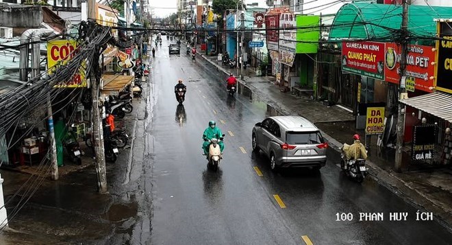
Rainstorms appear in rapid succession, early rain in Ho Chi Minh City and the South
Convective clouds are continuing to develop and expand, causing rain in many areas of the South.
On the morning of August 9, many areas in Ho Chi Minh City suddenly experienced thunderstorms accompanied by strong winds. On some roads such as 3 Thang 2, Ky Dong, An Duong Vuong..., rain caused many difficulties for people's travel.
According to the Southern Hydrometeorological Station, in the next 3 hours, convective clouds will continue to develop, causing showers and thunderstorms, accompanied by lightning in many areas of Ho Chi Minh City and surrounding areas.
Areas likely to experience rain include Cau Ong Lanh ward, Saigon ward, Binh Tien ward, Tan Hung ward, Phu Dinh ward, Dong Hung Thuan ward, Trung My Tay ward, Tan Thoi Hiep ward...
In the suburban area, thunderstorms are likely to appear in Can Gio, Cu Chi, Tan An Hoi, An Nhon Tay, Phu Hoa Dong, Binh My, Dong Thanh, Xuan Thoi Son and Ba Diem communes, then may expand to neighboring areas.
Common rainfall is from 5-20mm, in some places over 30mm. During thunderstorms, people need to be wary of tornadoes, lightning, hail and strong gusts of wind of about level 5-7, equivalent to 8-17m/s.
Through satellite cloud image monitoring, lightning positioning data and weather radar images, it shows that convective clouds still exist and tend to continue to develop and expand in many Southern regions.
In Dong Nai, Dak Lua and Nam Cat Tien areas have convective clouds. In Tay Ninh, thunderstorms are concentrated in Binh Hoa, Moc Hoa, Nhon Hoa Lap, Nhon Ninh and Hau Thanh. Dong Thap has Doc Binh Kieu, Thap Muoi, Thanh My and Phong Hoa; while in Can Tho, convective clouds appear in Trung Hung, Thoi Long and O Mon.
In the coming week, rain tends to concentrate more in the early and late days of the period, while rainfall may decrease in the middle days.
Read the original here